-
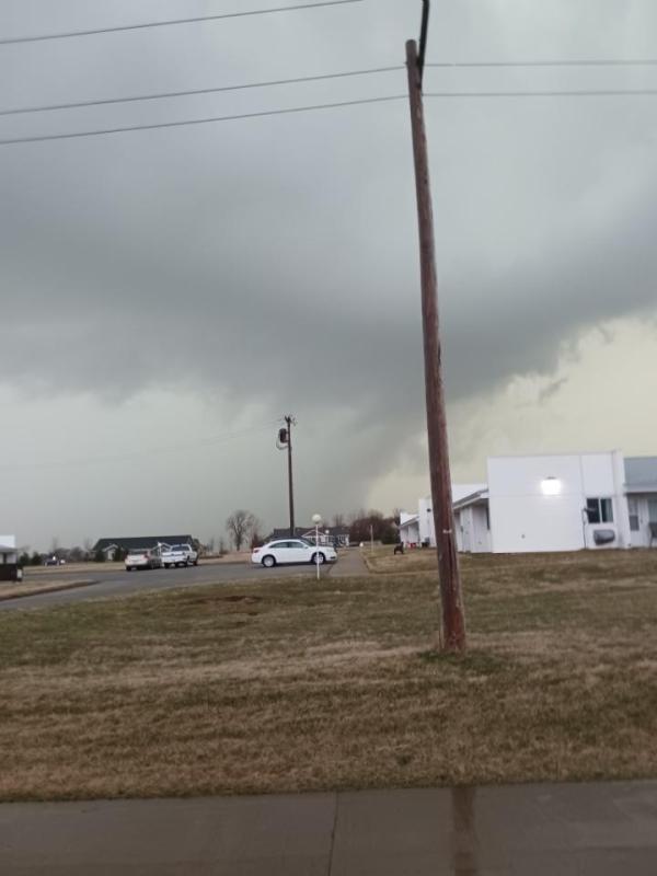 Probably a photo of the tornado that hit west of town. Taken near Windsor Manor.
 -
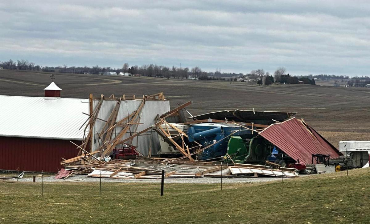 Some of the damage on the Johnson farm west of Vinton
 -
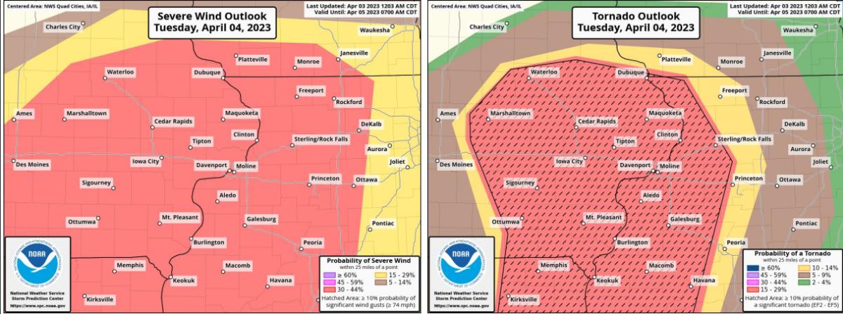 A look at Tuesday's incoming weather
 -
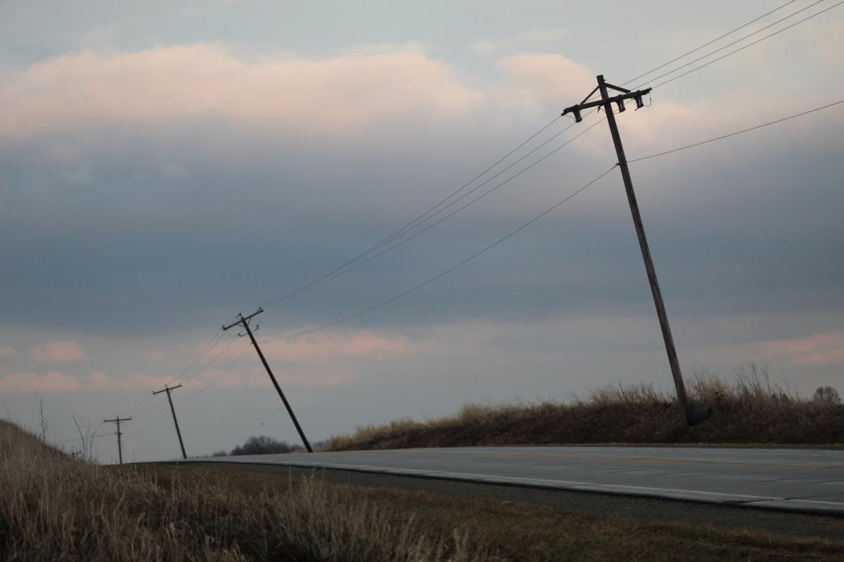 Electric poles along Hwy 218 were leaning following the storm
 -
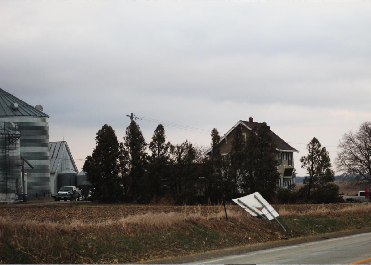 Road signs were easily flattened along Hwy 218
 -
UPDATED:
A note from Benton County Emergency Management sent an update on today's weather expectations.
"This morning ¢â‚¬â„¢s update includes some potential timing for the storms. Still predicting a significant severe weather event for afternoon/evening."
Please stay aware of what's happening outside today!
See file at the bottom of this article!
Friday afternoon, the promised weather storms arrived in Benton County. Striking at least two homes in rural Benton County.
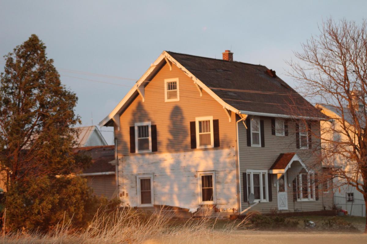
Near the Rodger's Park corner on Hwy 218 the Johnson farm was hit, damaging the home removing siding and shingles as well as flattening a barn on the farm. The tornado also damaged outbuildings on the farm.
A tornado also struck the Kevin and Julie Haefner residence near the Benton-Buchanan county line. Upending a trailer throwing it into the side of the house, removing the roof and destroying a section of the home, damage can be seen all around the property.
We aren't through.
You know it's not good when you get an email from Benton County Emergency Management's Scott Hansen. For the second time in less than a week, he contacted Vinton Today to warn residents to watch the weather tomorrow. On Tuesday, April 4, another significant severe weather outbreak looks possible. The Benton County areas is at a moderate risk. Hansen said it looks like the same kind of weather that came through on Friday.
Be aware of your surroundings, be prepared to take cover and have a shelter plan in place.
-We expect multiple rounds of severe weather starting Tuesday afternoon lasting through Wednesday morning.
-Long track supercells are possible again.
-Strong tornadoes, large hail and damaging winds are possible from the storms.
-Warm front will move north through the area.
Comments
Submit a CommentPlease refresh the page to leave Comment.
Still seeing this message? Press Ctrl + F5 to do a "Hard Refresh".