-
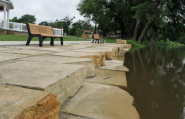 At 17.17 feet, the Cedar River water begins to cover the first step down from Celebration Park.
 -
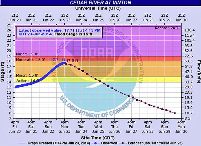 The Cedar River chart was updated at 4:15 to show a river level of 17.71 feet in Vinton.
 -
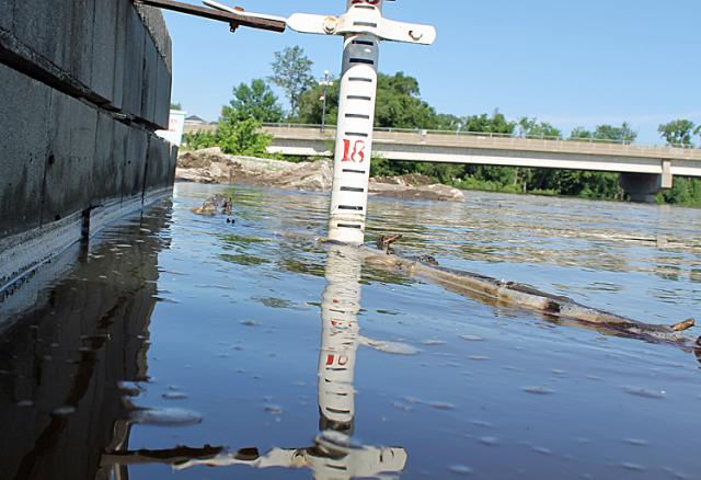 The flood gauge near the VMEU plant indicated that the river stopped rising overnight.
After a few anxious days for those who remember the impact of the Flood of 2008, the Cedar River has crested; the water level in Vinton is now slowly decreasing.
According to the most recent National Weather Service Cedar River web page, the river reached 17.81 feet Monday night, but had decreased to 17.51 feet by 9:15 a.m. this morning. That is considered "minor flooding."
A few streets in Vinton were covered with water on Monday, and the low-lying areas north of the Cedar River have been under water for a few days. But no homes were damages.
Benton County Emergency Management Agency Director Scott Hansen said on Friday that as long as there are no heavy rains in the Cedar River basin north of Vinton, there should be no threat of severe flooding.
The weather forecast for the area does not predict any chance of rain until Wednesday, when a 30 percent chance is expected.

Comments
Submit a CommentPlease refresh the page to leave Comment.
Still seeing this message? Press Ctrl + F5 to do a "Hard Refresh".